
India, the 7th largest country with total area 3, 287, 263 sq km, land about 2, 973, 190 sq km & water 314, 400 sq km is situated in South Asia. India is officially known as Republic of India. The capital of India is Delhi. The large country shares it’s border with Pakistan to the west, China, Nepal & Bhutan to the north-east; & Bangladesh & Burma to the east.
Sri Lanka, the Maldives, are the neighboring countries in the Indian ocean to the south. India is surrounded by three oceans-Indian Ocean on the south, the Arabian Sea on the west, & the Bay of Bengal on the east.
India had been recognized for centuries for its cultural wealth. Four great religions-Hinduism, Buddhism, Jainism & Sikhism had been flourished here. & several other religions like Zoroastrianism, Judaism, Christianity & Islam had arrived in the region in the next millennium. India had become a colonial kingdom of United Kingdom in early 18th century. In 1947 on 15th August India had gained freedom after a bloodshaded struggle of 200 years.
India has turned up to have the second fastest growing large economy, though poverty, illiteracy, & malnutrition still exist.
Links:
- India Bangladesh Bus Train Service
- India Visa Application
- India NewsPapers
- India Advertising Agencies
India HISTORY
The great Indus Valley Civilization had flourished in western India 3300 BC. Later Vedic Culture grew followed by Hinduism in 500 BC. Around 550 BC Mahajanapadas were set up. A number of dynesties-Maurya, Kushan, Gupta, Chalukyas, Rashtrakutas, Hoysalas, Pallavas, Pandyas, & Cholas reigned in India. The period of Gupta dynesty (4th to 6th centuries A. D) was considered as the Golden Age.
Later between 10th & 12th centuries rulers of Delhi Sultanate & Mughal ruled over north India. By the end of 17th century Mughal empire was overshadowed by the Marathas.
By the end of 16th century, many European countries like Portugal, the Netherlands, France, & the United Kingdom discovered India as a lucrative trading centre.
Flag of India

Gradually India came under the control of East India Company at the end of 1856. In 1857 a nationwide Sipoy Mutiny had shaken the British empire which ultimately failed due to various reasons. As a consequence India became a colonial state under UK.
In the beginning of 20th century Indian National Congress started struggle for independence. In 1947 on 15th august India got freedom but at the cost of the partition of India-Pakistan as demanded by the Muslim League.
India GEOGRAPHY:
India is bounded by Himalaya Range in the north, Aravalli Range in the west, Satpura & Vindhya ranges in central India.
Two important rivers The Ganges & The Brahmaputra & their tributories drain into Bay of Bengal. Two tributories of the Ganges, Yamuna & Koshi cause flood sometimes. India’s coast line is 7, 517 kilometers long.
The Thar Desert & Rann of Kutch in the west, the Sundarbans delta in the east have completed the territory of India. It has two archipelagos: the Lakshadweep & the Andaman & Nicobar Islands.
CLIMATE:- Northern part of the country observes mild cold weather, while in southern part tropical climate persists. Western part is mostly dry & desert.
India GOVERNMENT
The constitution of India, the longest in the world was imposed in 1950 on 26th January. The preamble of the constitution defines India as a sovereign, socialist, secular, democratic republic country. The government has three departments- Legislature, Executive, & Judiciary. Parliament, the legislature of India is formed of Rajya Sabha & Lok Sabha. The Executive section consists of the President, Vice-President, & the Council of Ministers. The Judiciary branch consists of the Supreme Court, led by the Chief Justice of India, twenty-one High Courts, & a number of other courts.
Links:
- India Bangladesh Bus Train Service
- India Visa Application
- India NewsPapers
- India Advertising Agencies
Name of the Capital of India is ‘New Delhi’.
Number of states in India
States are:
1. Andhra Pradesh
2. Arunachal Pradesh
3. Assam
4. Bihar
5. Chhattisgarh
6. Goa
7. Gujarat
8. Haryana
9. Himachal Pradesh
10. Jammu and Kashmir
11. Jharkhand
12. Karnataka
13. Kerala
14. Madhya Pradesh
15. Maharashtra
16. Manipur
17. Meghalaya
18. Mizoram 19. Nagaland
20. Odisha
21. Punjab
22. Rajasthan
23. Sikkim
24. Tamil Nadu
25. Telangana
26. Tripura
27. Uttar Pradesh
28. Uttarakhand
29. West Bengal
A. Andaman and Nicobar Islands
B. Chandigarh
C. Dadra and Nagar Haveli
D. Daman and Diu
E. Lakshadweep
F. National Capital Territory of Delhi
G. Puducherry
India President
Ram Nath Kovind
• Vice-President
Venkaiah Naidu
• Prime Minister
Narendra Modi
• Chief Justice
Dipak Misra
• Lok Sabha Speaker
Sumitra Mahajan
what is Indian economy
According to the International Monetary Fund (IMF), the Indian economy in 2017 was nominally worth US$2.454 trillion; it is the 6Th-largest economy by market exchange rates, and is, at US$9.489 trillion, the 3rd-largest by purchasing power parity, With its average annual GDP growth rate of 5.8% over the past 2 decades, and reaching 6.1% during 2011–12, India is one of the world’s fastest-growing economies, However, the country ranks 140th in the world in nominal GDP per capita and 129th in GDP per capita at PPP.
India Agriculture: rice, wheat, oilseed, cotton, jute, tea, sugarcane, potatoes.
India Industries: textiles, chemicals, food processing, steel, transportation equipment, cement, mining, petroleum, machinery, software.
India Natural resources: coal (4th largest in the world), iron ore, manganese, mica, bauxite, titanium ore, chromite, natural gas, diamonds, petroleum, limestone,
India Currency: Rupee
India CULTURE: Taj mahal is the greatest instance of Indian architecture. world’s biggest Hindu Temple, the Srirangam Temple is situated in Tiruchirappalli, Tamil Nadu. The rich tradition of Indian classical music is provincially devided into North Indian Hindustani & South Indian Carnatic gharana. Some great Indian classical dances are bharatanatyam of Tamil Nadu, kathak of Uttar Pradesh, kathakali & mohiniyattam of Kerala, kuchipudi of Andhra Pradesh, manipuri of Manipur, odissi of the state of Orissa. Rabindranath Tagore won the Nobel Prize in 1913. India’s national sport is field hockey. India won World cup cricket in 1983. Indian Film Industry is the biggest in the world.
UNICEF In India : UNICEF has made significant steps in wiping out polio from India. Unicef in India is consistently campaigning to get rid of AIDS, malnutriton, and tries to greaten literacy.
Population of India
India is the second most populated country, Total population: 1, 132, 446, 000.
Population Growth rate of India: 1. 6%
Birth rate in India: 22. 7/1000
Infant mortality rate: 34. 6/1000
Life expectancy: 68. 6 years
Population Density per sq mi in India: 984 people
Literacy rate: 61% (2005 est. )
RELIGION in India:
79.8% Hinduism
14.2% Islam
2.3% Christianity
1.7% Sikhism
0.7% Buddhism
0.4% Jainism
0.9% others
India Labor Force
The 513.7-million-worker Indian labor force is the world’s second-largest, as of 2016 The service sector makes up 55.6% of GDP, the industrial sector 26.3% and the agricultural sector 18.1%. India’s foreign exchange remittances of US$70 billion in 2014,
India LANGUAGE: Hindi(30%)is the National language.
Other Official languages are English, Bengali, Gujarati, Kashmiri, Malayalam, Marathi, Oriya, Punjabi, Tamil, Telugu, Urdu, Kannada, Assamese, Sanskrit, Sindhi.
RACE: Indo-Aryan 72%
Dravidian 25%
Mongoloid & other 3% (2000)
What time is it in India?
Calculation of Current time in India
India Time or Indian Standard Time (IST) is calculated with a time offset of GMT+05:30. For example, If GMT time is 9am, you can calculate current time of India with adding 5:30 hours with current GMT time. that is 9:00 + 5:30 = 14:30pm i.e. 2:30pm same day. There is no daylight observation in India. Current Local Time of India is calculated on the basis of 82.30′ East longitude.
<!-Local Time Clock widget – HTML code – localtimes.info –>
 Time in New Delhi
 <!-end of code–>
India time zone : There is no multi-time zone in India. Indian governenment did not take any decesion on Time zone.
India local time Distance from East to West:
Indian Easter area to weastern area distance is 2933 kilometers, and India east zone and west zone time distance is more than 2 hours.
That means, In the east zone, the sun rising and setting almost 2 hours earlier than in the Rann of Kutch in the far west.
India Time Now:
In 2001, the Indian Government established a 4 member committee under the Ministry of Science and Technology to examine the need for
multiple time zones and daylight saving for India. But did not take any decision by the parliament.
Local Time in India
The movie maker Jahnu Barua has been started a campaign for a separate time zone for the past 25 years. In 2010, Jahnu Baua
suggested creating a separate time zone in India for the Development of Northeastern Region.
In 2014, CM of Assam Tarun Gogoi started campaigning for another time zone in India, specially for Assam and other northeastern states
of India. But Center govenment of India did not approve that.
India Main CITIES: Delhi is the capital city. Other Largest cities are mumbai(largest), Kolkata, Bangalore, Chennai, Ahmedabad, Hyderabad, Kanpur.
Links:
- India Bangladesh Bus Train Service
- India Visa Application
- India NewsPapers
- India Advertising Agencies
More from my site
 Dhaka University – Department | Admission | History
 New Developments in the Education System of India
 Hotels in Bangladesh – 5 star hotel in Dhaka
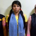 Actress Quazi Nawshaba Ahmed Arrested allegedly spreading rumours on student protests for safe roads
 Medical Clinics and Medical Clinic Near me in the United States
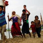 Rohingya Crisis – Permanent Solution to return Rohingyas to their Homeland Arakan in Myanmar


